Pipeline Road


Take the right fork to head back over to Quail Springs Road and down to Soda Lake Road.
|
Pipeline Road
|
 |
||||||||||||||
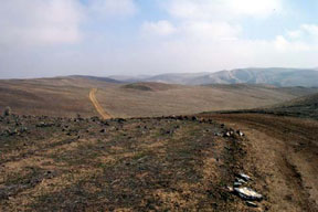
| Pipeline Road connects to Quail Springs Road, both of which are accessible from Soda Lake Road. This makes for a fun and easy 10 mile loop with great views. This is a view from Quail Springs road. | |||||||||||||||
 |
|||||||||||||||
| The entrance to Pipeline Canyon Road is approximately 4 miles North from Hwy 166, just beyond the Elkhorn Road turn off at N34°59.630' W 119° 29.291' There is a sign marker on the East side of the road, but it is nearly 100 yards from the actual entrance, and around a corner which prevents you from seeing the actual roadway from the sign marker. Notice the white "Access" paddle marker here. | |||||||||||||||
 |
|||||||||||||||
| The first portion of Pipline is rather non-descript in my opinion. Like other public access roads in the area, it is well graded and poses no threat to beginners. | |||||||||||||||
 |
|||||||||||||||
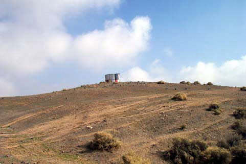
| At about 1 mile in, you'll find yourself looking at the water tank up on the hill in the distance. The road passes directly by this tank. See below. | |||||||||||||||
 |
|||||||||||||||
| This is the tank seen in the distance above, from a point on the road up and over to the West. Notice the ruts. Keep the heck out of there! About one more rider getting caught tearing up the area will close it. | |||||||||||||||
 |
|||||||||||||||
| At a point 1.8 miles in, you'll come to this fork. The left continues up Pipeline road, while the right takes you over to Quail Springs Road. | |||||||||||||||
 |
|||||||||||||||
| Another mile of easy road in brings you to this flat where an old, but apparently still in current use, cattle pen exists. On down the road through the canyon visible to the left eventually takes you down into the wash below. | |||||||||||||||
 |
|||||||||||||||
| The road down through this wash continues another mile or so, and dead-ends against the Erro Ranch in the Cuyama Valley. There is no outlet to the Cuyama area. You get to retrace your steps from here. | |||||||||||||||
 |
|||||||||||||||
| Taking the right fork mentioned above leads you across this plateau Northwest toward Quail Springs--> | |||||||||||||||
 |
|||||||||||||||
| 2.4 miles from the Pipeline junction brings you to this "Y". The left continues another 1.6 miles up to a summit offering a spectacular panorama of the Plains.
Take the right fork to head back over to Quail Springs Road and down to Soda Lake Road. |
|||||||||||||||
|
|
|||||||||||||||